BRCC Running Guide
  • Overview
  • BRCC Running Guide
    • Planning Runs From BRCC >
      • Running Schedule Suggested
      • Printing of Schedule
  • Moses Cone Park Trails
    • Bass Lake
    • Trout Lake Loop
    • Bass Lake to Rich Mtn. & Return
    • Flat Top Mountain
    • Manor House Loop
    • Black Bottom Loop
  • Other Trails to Consider
    • Virginia Creeper Trail
    • Trails Within Short Driving Distances
Picture
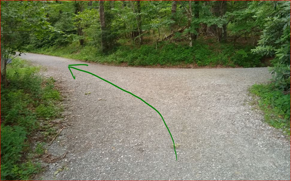
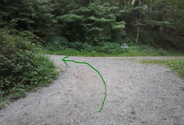
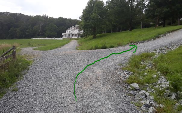
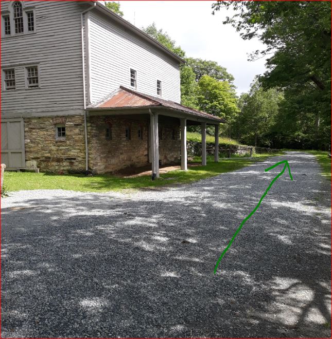
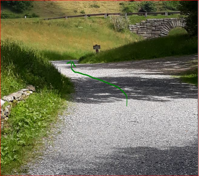
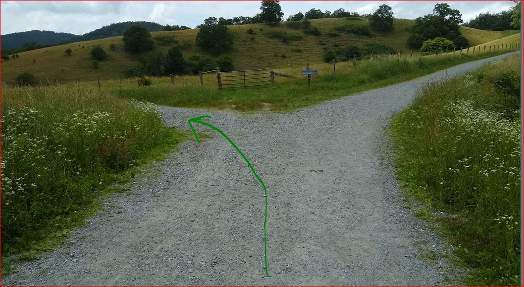
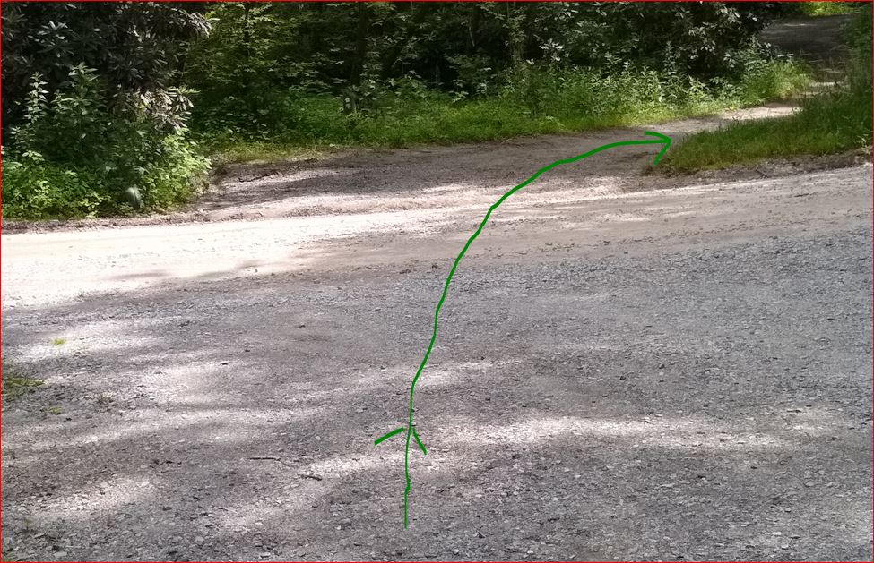
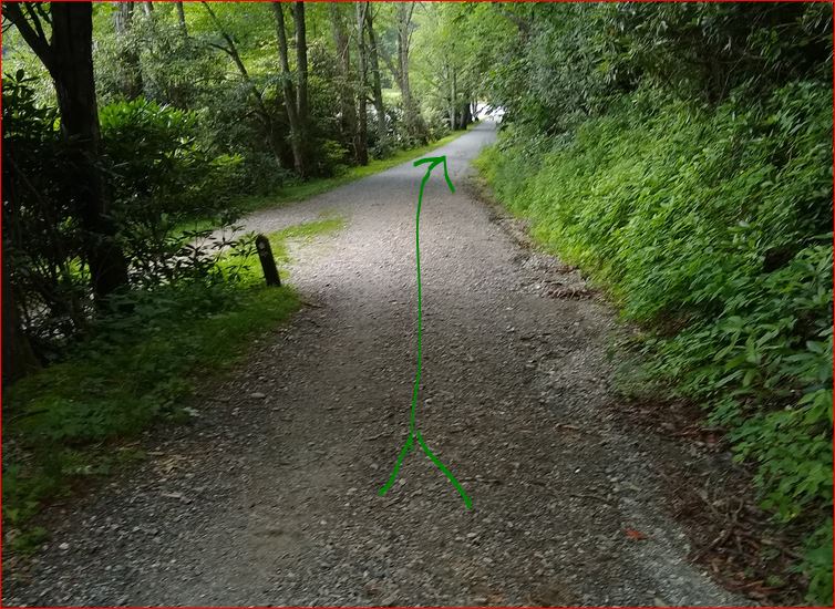
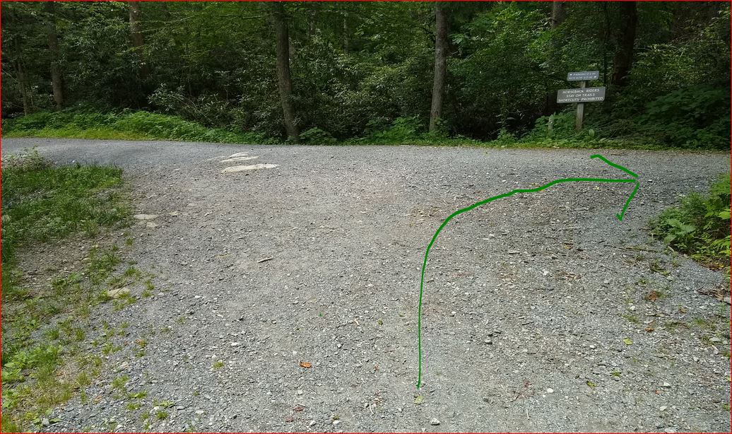
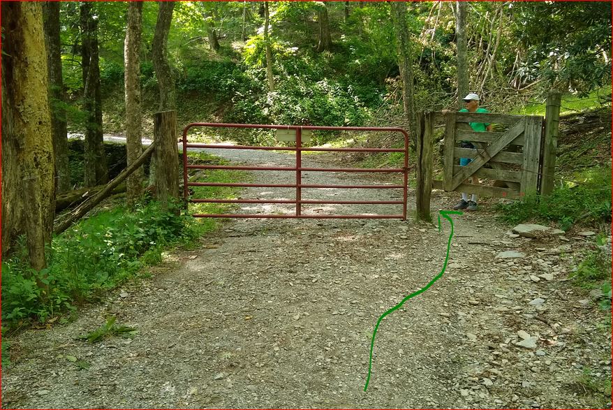
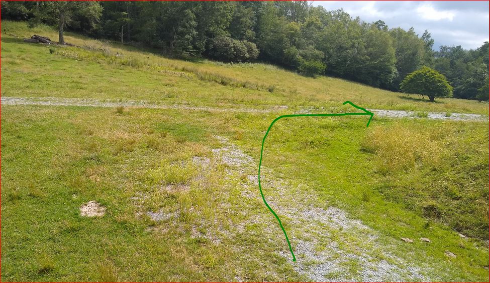
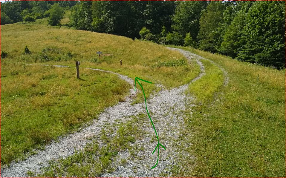
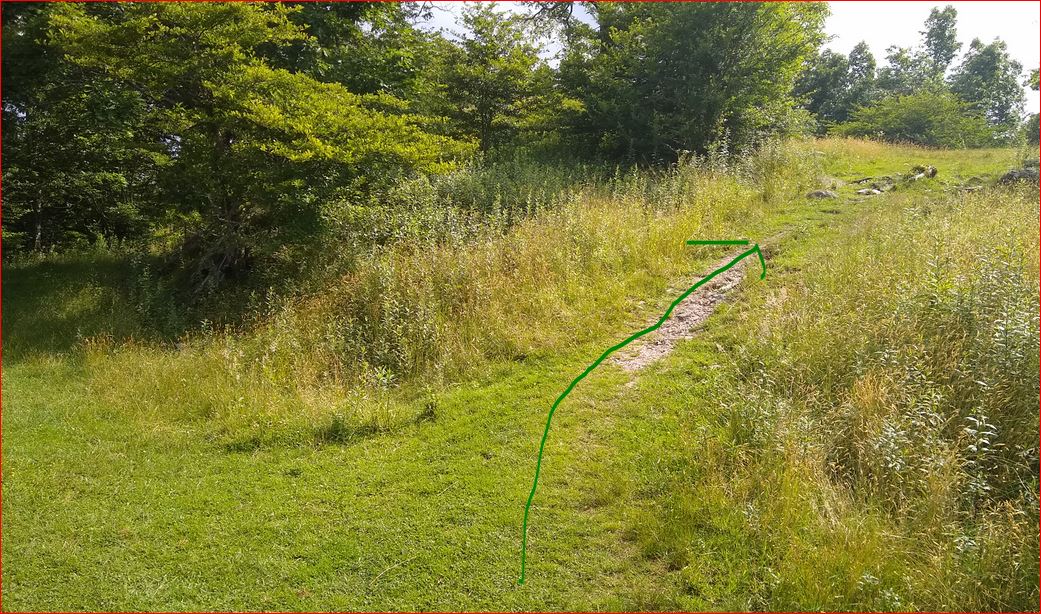
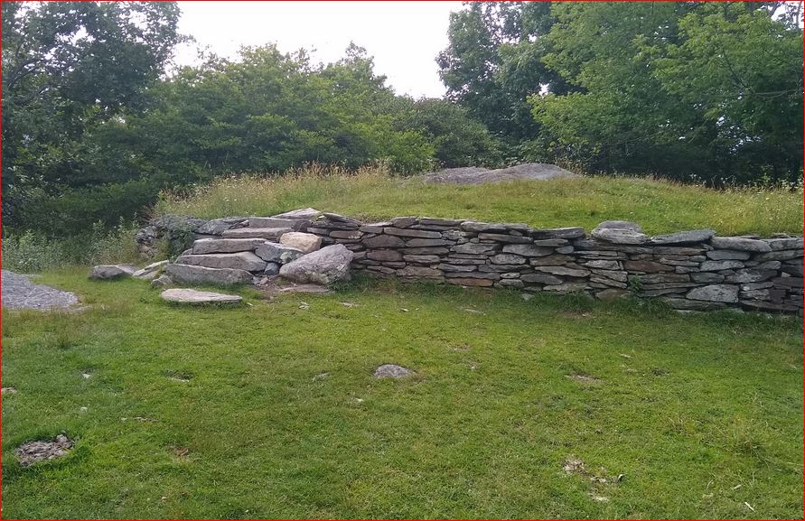
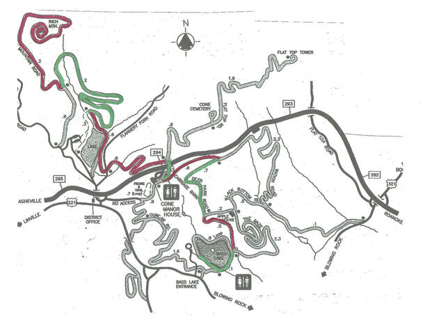
On the map above the trail has been colored alternating green and red.  At the end point of each color a picture will be shown indicating the correct turn to take.  The round trip from Bass Lake to the top of Rich Mountain is 14.36 miles.  There are some turns that are tricky and if you go wrong you may never get back.

Below on this page you can see pictures of the critical turns going from Bass Lake to the top of Rich Mountain.

To see pictures of the turns going from the Top of Rich Mountain back down to Bass Lake     
CLICK HERE

From the parking lot to the Manor house is 2.09 miles.  You start near the parking area running on the 1st green section of the map which will be counter clockwise around the lake.  Just keep the lake on your left.  In .37 mile you should cross over a bridge with stone side rails. 
That is where you should go up the trail on the right. 

Picture
In .37 mile you should cross over a bridge with stone side rails. That is where you should go UP the trail on the right not the trail by the lake.
Picture
In a half mile you should go straight. Do not take the trail to the right that goes to the Apple Barn.
Picture
The next turn is .73 mile up the trail. It is critical that you make the sharp left turn to go up toward the Manor House
Picture
The next turn is a very steep but short hill to the right.
Picture
At the top of that steep hill you should turn right and pass in front of the Carriage House.
Picture
Just after the Carriage House you will see the Blue Ridge Parkway. The trail will take you to a short tunnel under the parkway.
Picture
When you come out of the tunnel you should turn left DOWN the hill.
Picture
Follow the winding downhill trail and you will go across Flannery Fork Road
Picture
After a short distance you will intersect the Trout Lake Trail
Picture
You should cross the dam and go .21 mile and make a very sharp right turn up the mountain.
Picture
After a 1.24 miles you will come to a gate to go throught
Picture
The next turn is a sharp turn to the right. Do not go left down the steep hill to Trout Lake. Remember this turn for the trip down.
Picture
Then you should take the trail that forks to the left.
Picture
Just stay on the main trail for 1.86 miles. Near the top you will see some narrow trails off to the right but don't take the first two. Take the one that looks like this.
Picture
You made it if you see this.
To view the turns from the top of Rich Mountain Back down to Bass Lake       Click Here
For a version suitable for Printing Click Here
Powered by Create your own unique website with customizable templates.
  • Overview
  • BRCC Running Guide
    • Planning Runs From BRCC >
      • Running Schedule Suggested
      • Printing of Schedule
  • Moses Cone Park Trails
    • Bass Lake
    • Trout Lake Loop
    • Bass Lake to Rich Mtn. & Return
    • Flat Top Mountain
    • Manor House Loop
    • Black Bottom Loop
  • Other Trails to Consider
    • Virginia Creeper Trail
    • Trails Within Short Driving Distances